Achieving Resilient Road Infrastructure through Enhanced Surveying Techniques
 Sonal Kumar
 Oct 03, 2024
As climate change intensifies and urbanization accelerates, global road infrastructure faces mounting pressure. With extreme weather events becoming more frequent, resilient road networks are critical to ensuring public safety, supporting economic growth, and enhancing societal well-being. Cutting-edge surveying technologies are now proving essential in building and maintaining roads that can withstand these challenges while improving overall efficiency.
The World Bank estimates that road crashes in low- and middle-income countries cost an estimated $1.85 trillion annually. This staggering figure highlights the need for improved road infrastructure and safety measures. Moreover, the United Nations forecasts that by 2050, 68% of the world’s population will live in urban areas, emphasizing the importance of resilient road networks in supporting sustainable development.
The Role of Advanced Surveying Techniques in Road Resilience
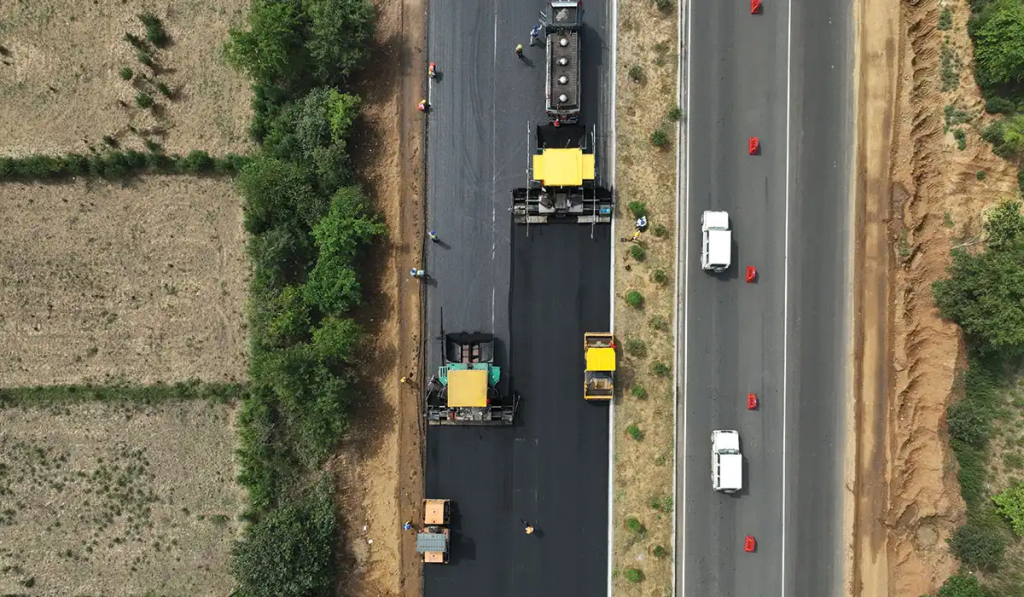
At the core of resilient road infrastructure are advanced surveying techniques that leverage technologies like LiDAR (Light Detection and Ranging), photogrammetry, and Ground Penetrating Radar (GPR). These tools enable engineers to create highly accurate 3D models of road networks and surrounding terrains, allowing for better design, construction, and maintenance.
LiDAR uses laser pulses to generate precise point clouds that provide accurate topographic data. This helps engineers design roads that consider critical factors like drainage, slope stability, and sight distances. Photogrammetry, which uses high-resolution images, complements LiDAR by creating orthomosaic maps and facilitating visual inspections.
GPR is particularly valuable for detecting subsurface anomalies that can compromise road foundations. By identifying these potential weak points early, GPR helps prevent costly road failures. This proactive approach, coupled with advanced scanning technologies, enhances predictive maintenance by flagging issues before they escalate into major problems. This not only ensures safer roads but also optimizes maintenance budgets by targeting repairs where they are most needed.
Case Studies
The Netherlands: Pioneering Mobile Mapping for Road Maintenance
The Netherlands has long been an innovator in infrastructure management. Its nationwide mobile mapping program for road maintenance is a prime example of using advanced surveying techniques. Equipped with LiDAR scanners and high-resolution cameras, vehicles rapidly survey thousands of kilometres of roads, creating detailed 3D models.
This continuous monitoring enables predictive maintenance and rapid responses to emerging issues. As a result, the Netherlands has achieved a 15% reduction in road maintenance costs and a 20% improvement in road safety over the last five years.
Japan: Resilience Through Advanced Geotechnical Surveys
Japan’s vulnerability to natural disasters makes resilient infrastructure a priority. By combining GPR technology with traditional geotechnical methods, Japan has significantly enhanced its ability to assess slope stability and landslide risks along mountain roads. This integrated approach has reduced road closures due to landslides by 30% and lowered repair costs by 25% over the past decade, cementing Japan’s leadership in resilient road design.
India: Embracing Technology for Rural Road Development
India’s Pradhan Mantri Gram Sadak Yojana (PMGSY) program aims to provide all-weather road connectivity to rural areas. Advanced surveying techniques, including drones for aerial mapping and LiDAR for terrain analysis, have greatly improved the speed and precision of road planning in remote regions. The result has been a 40% reduction in project completion times and a 25% improvement in road quality compared to traditional methods.
Conclusion
Enhanced surveying techniques are playing a pivotal role in building resilient road infrastructure worldwide. Technologies like LiDAR, photogrammetry, and GPR are transforming how we design, construct, and maintain road networks, making them better equipped to handle the pressures of climate change and urbanization.
These technologies not only improve road safety and durability but also contribute to sustainability by optimizing resource use and minimizing environmental impacts. The upcoming AEC Forum will provide an excellent platform to explore the broader application of these tools in road infrastructure, railways, and water utilities. With the collaboration of experts, policymakers, and industry leaders, the event promises to drive innovation and foster more resilient and sustainable infrastructure solutions.